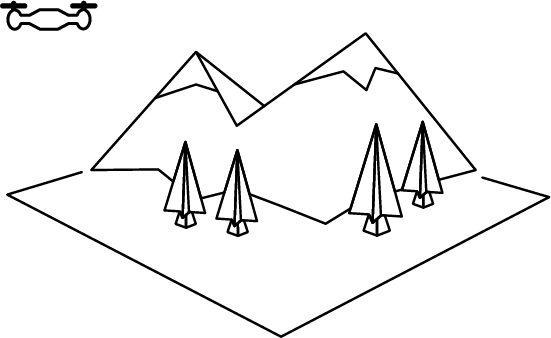
It saves valuable time: a drone relief is usually faster than a normal relief and certainly involves less resources.
2
With a drone you can easily and quickly access areas that are usually difficult to reach: no more difficulties and distances.
3
With only one overflight, you can get different output types: 2D and 3D surveys and much more. This consequently means a cheaper affair.
Services
In order to satisfy every customer’s request, we can offer different services with different specific equipment. If necessary, in order to offer complete and efficient services, we can rely on many collaborators and professionals.
2D topographical surveys
2D topographical surveys
When no altitudes are required but only a photographic representation from above we make a photogrammetry with 2D drone. For example for cadastral maps overlays.
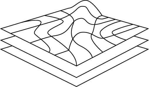
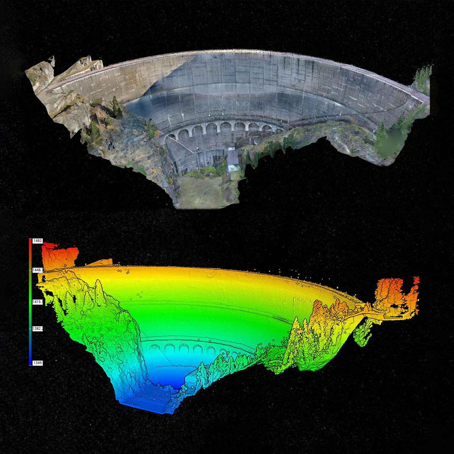
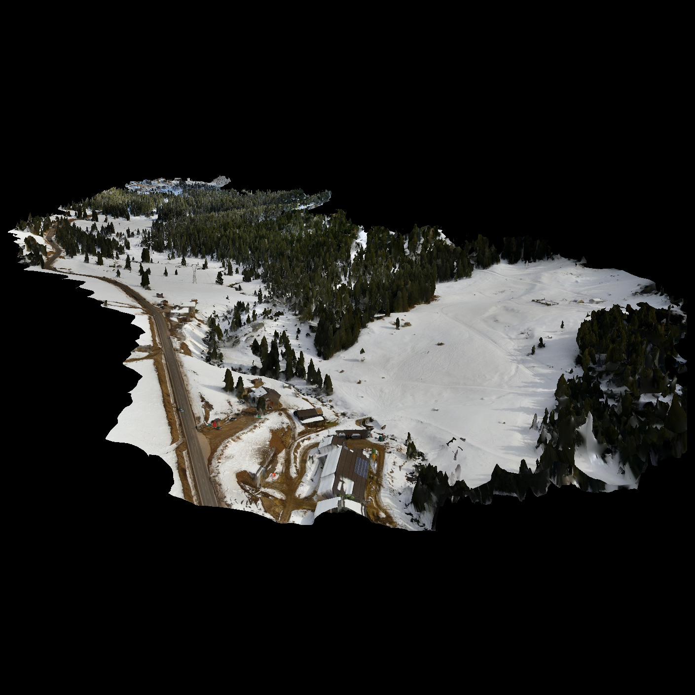
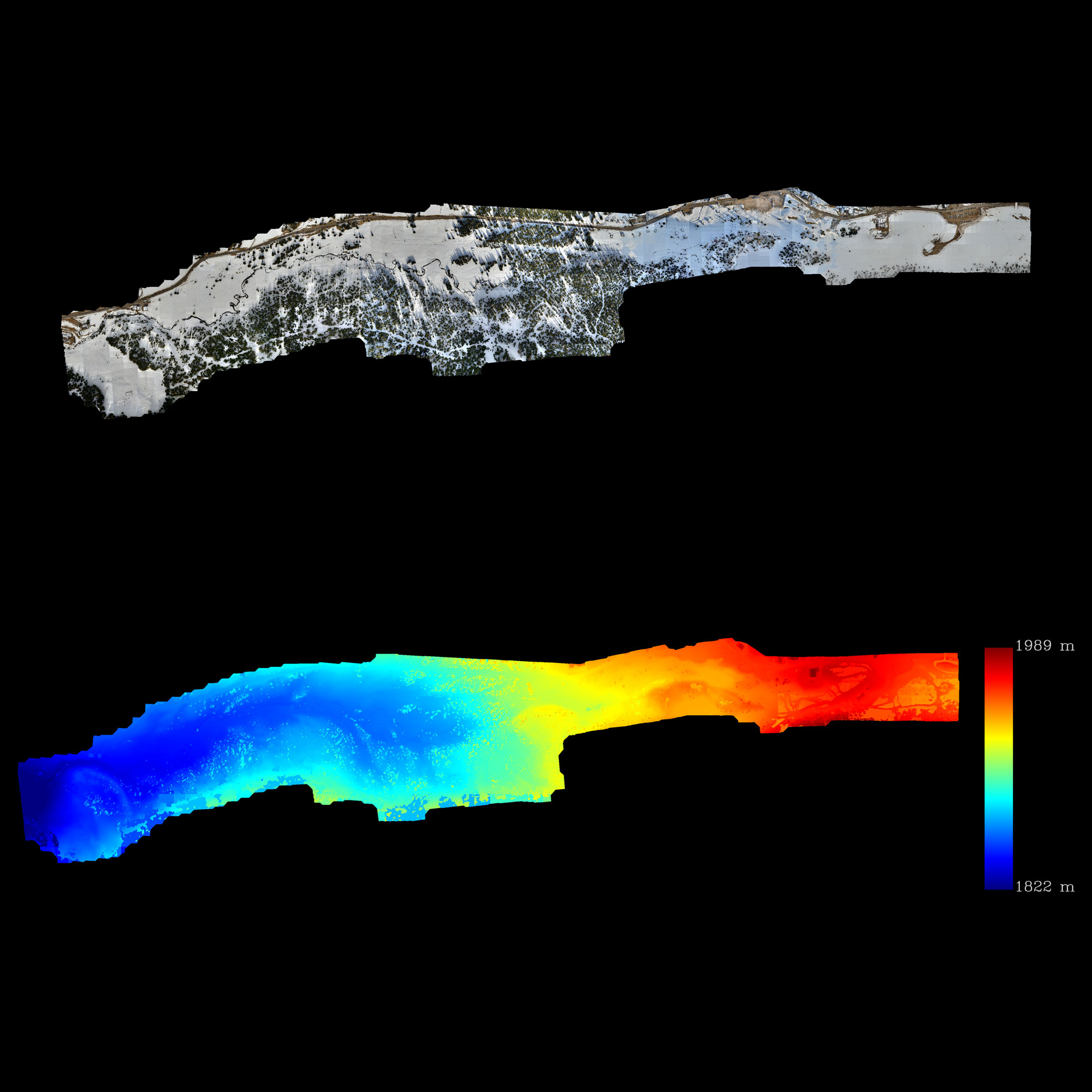
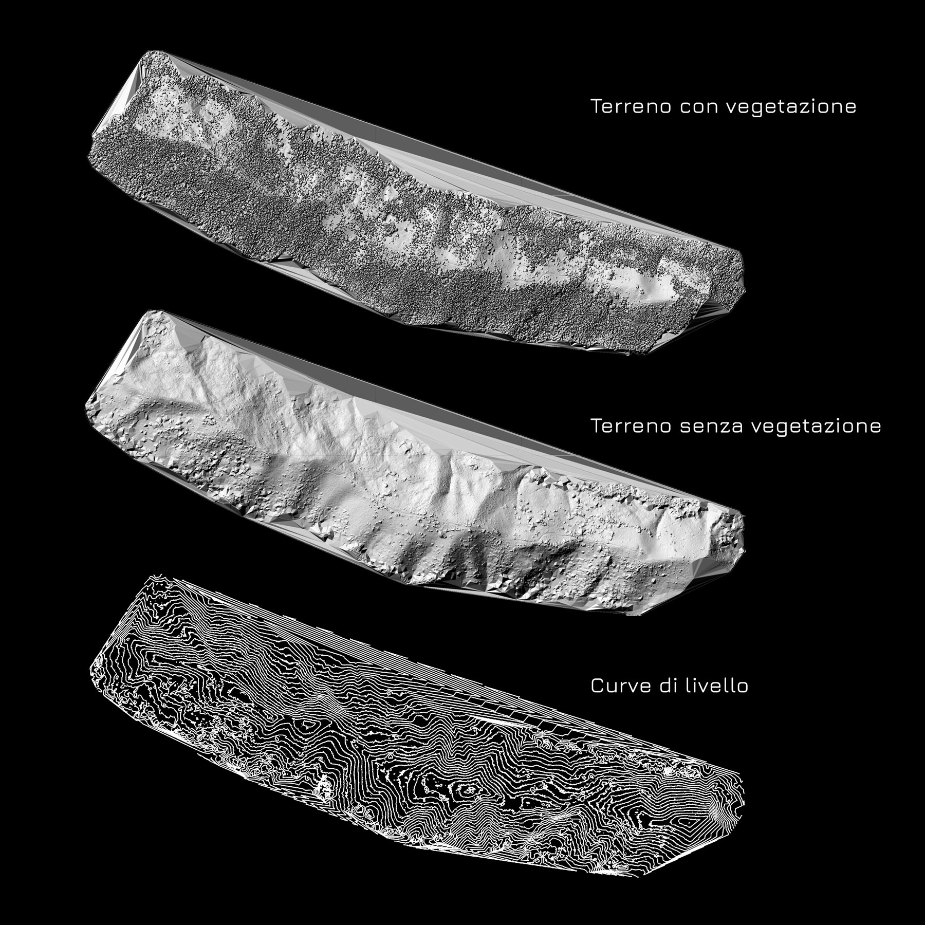
3D surveys of areas and plots
3D surveys of areas and plots
Aerial survey with drone to obtain the level curves of the relief area and the creation of digital terrain models (DSM and DTM). These are useful for potential use in the future and to understand the movement of the ground.
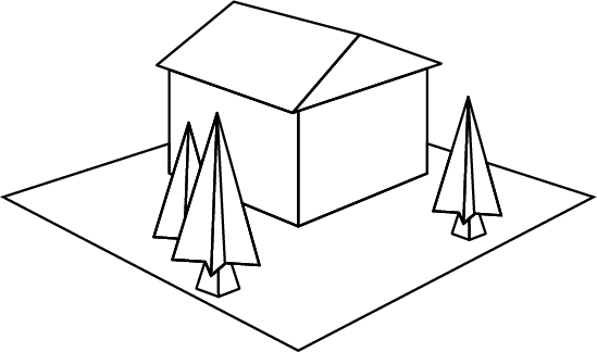
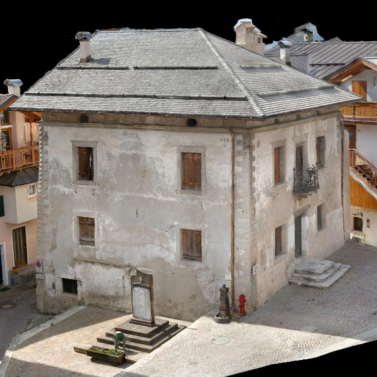
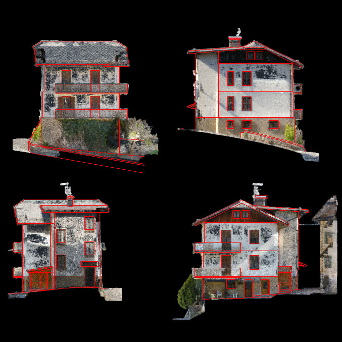
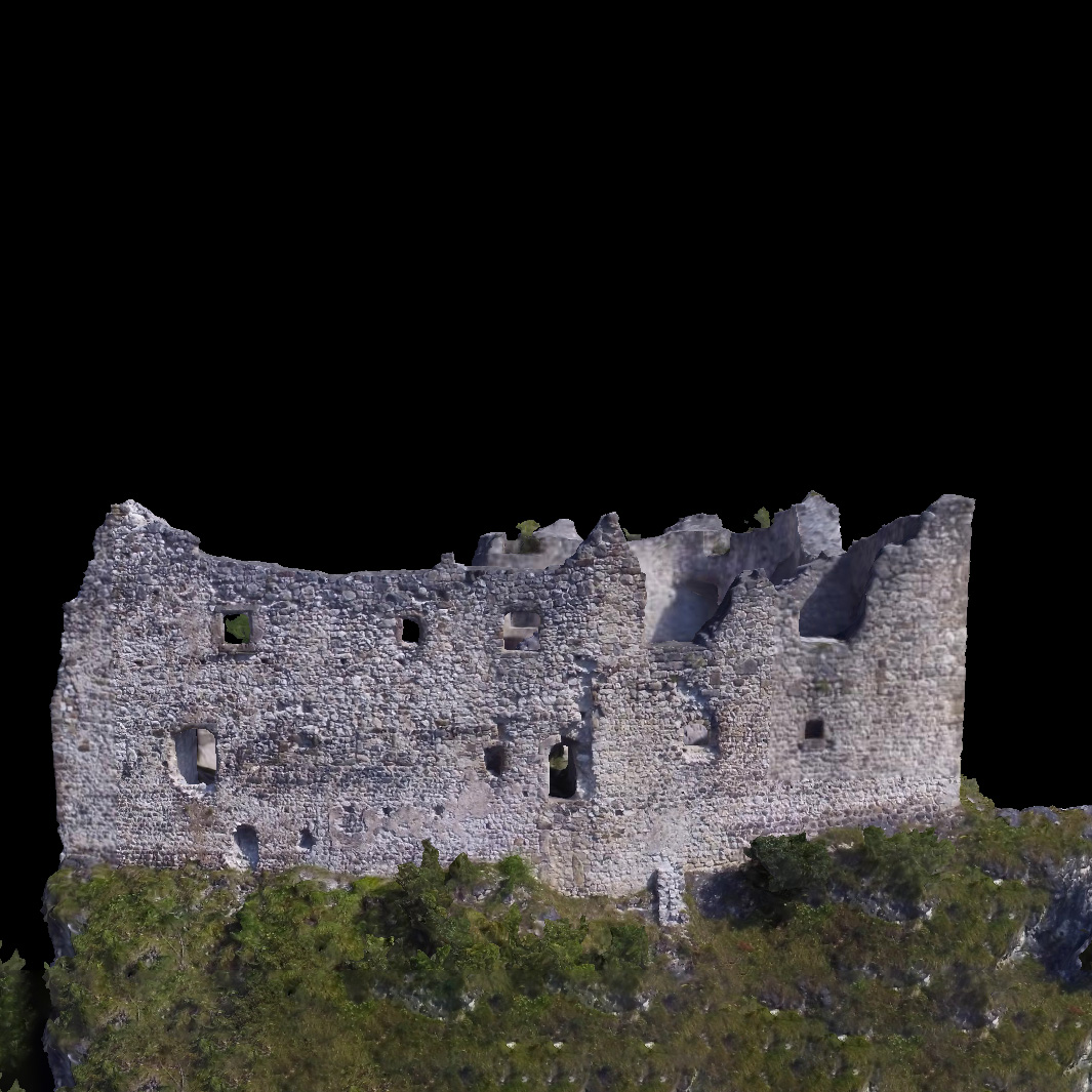
3D surveys of buildings and structures
3D surveys of buildings and structures
Architectural drone reliefs with the aim of obtaining a 3D model and a point cloud survey. These are useful for example to create building plans and graphic representations.
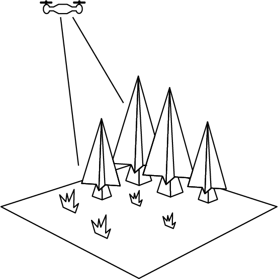
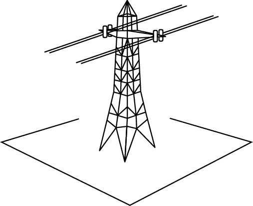
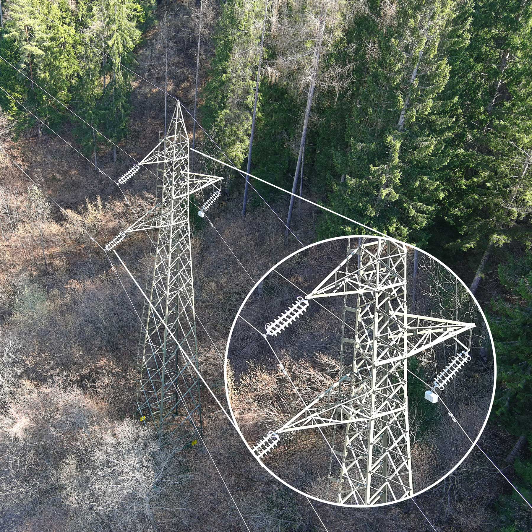
Remote inspections with drone
Remote inspections with drone
Drone inspections and analysis of structures, roofs, antennas, power lines, bridges and buildings with video and/or photographs production.
LIDAR surveys with drone
LIDAR surveys with drone
Drone surveys using LIDAR technology to perform surveys in the open field but also in wooded areas.
Drone rental with operator
Drone rental with operator
Drone rental service with operators only for the relief parts or images without processing.
Aerial shooting with drone
Aerial shooting with drone
Production of aerial videos and aerial photo shoots with drone from points of view normally inaccessible.
Technical support / Surveyor
Technical support / Surveyor
Surveyor’s knowledge consultancy services, such as planning, cadastral and topographic services, and construction site security.
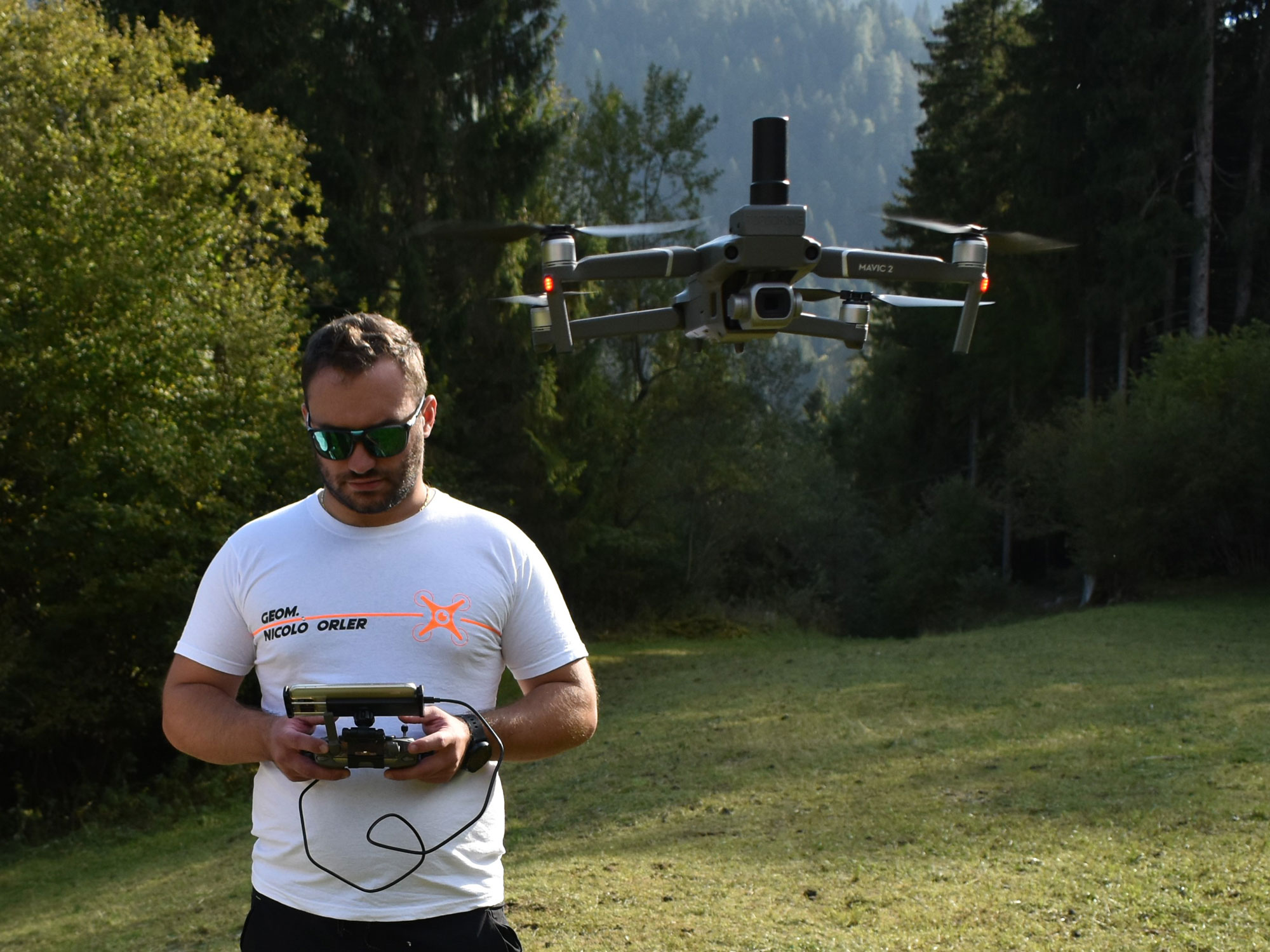
Drones
Depending on the request, we have different types of Drone. Thanks to our Network we are able to organize flyovers equipped with high technology equipment.
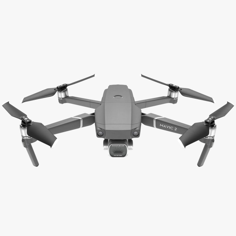
DJI Mavic 2 PRO
Autel EVO 2 RTK for precision surveys
DJI Mavic mini for congested areas: it weighs less than other drones with its 250gr
Customer portfolio
Comune di Imer
Comune di Mezzano
Comune di Moena
Comune di Ziano
Primiero Energia
Provincia Autonoma di Trento
Projects
3D drone surveys of residential and industrial buildings
Ispezioni e monitoraggi aree difficilmente raggiungibili
3D surveys of areas and plots
LIDAR surveys with drone
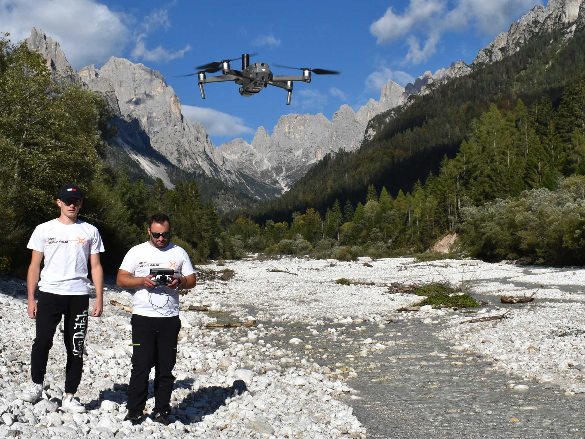
Team
The On-Drones team consists mainly of Nicolò Orler, company’s founder and surveyor. In order to achieve the goal with the highest precision and professionalism, at his side work some collaborators depending on the necessary help needed. A dynamic and responsible Team, which is in constant evolution and formation.
May 2016: SAPR pilot certificate acquisition (drones);
November 2021: conversion of the certificate to A1/A3 according to the new legislation and acquisition of a new certificate A2.
Google Analytics è un servizio di analisi web fornito da Google Ireland Limited (“Google”). Google utilizza i Dati Personali raccolti per tracciare ed esaminare l’uso di questa Applicazione, compilare report sulle sue attività e condividerli con gli altri servizi sviluppati da Google. Google può utilizzare i tuoi Dati Personali per contestualizzare e personalizzare gli annunci del proprio network pubblicitario. Questa integrazione di Google Analytics rende anonimo il tuo indirizzo IP. L'anonimizzazione funziona abbreviando entro i confini degli stati membri dell'Unione Europea o in altri Paesi aderenti all'accordo sullo Spazio Economico Europeo l'indirizzo IP degli Utenti. Solo in casi eccezionali, l'indirizzo IP sarà inviato ai server di Google ed abbreviato all'interno degli Stati Uniti.
Dati Personali raccolti: Dati di utilizzo; Strumento di Tracciamento.
Google Fonts è un servizio per visualizzare gli stili dei caratteri di scrittura gestito da Google Ireland Limited e serve ad integrare tali contenuti all’interno delle proprie pagine.